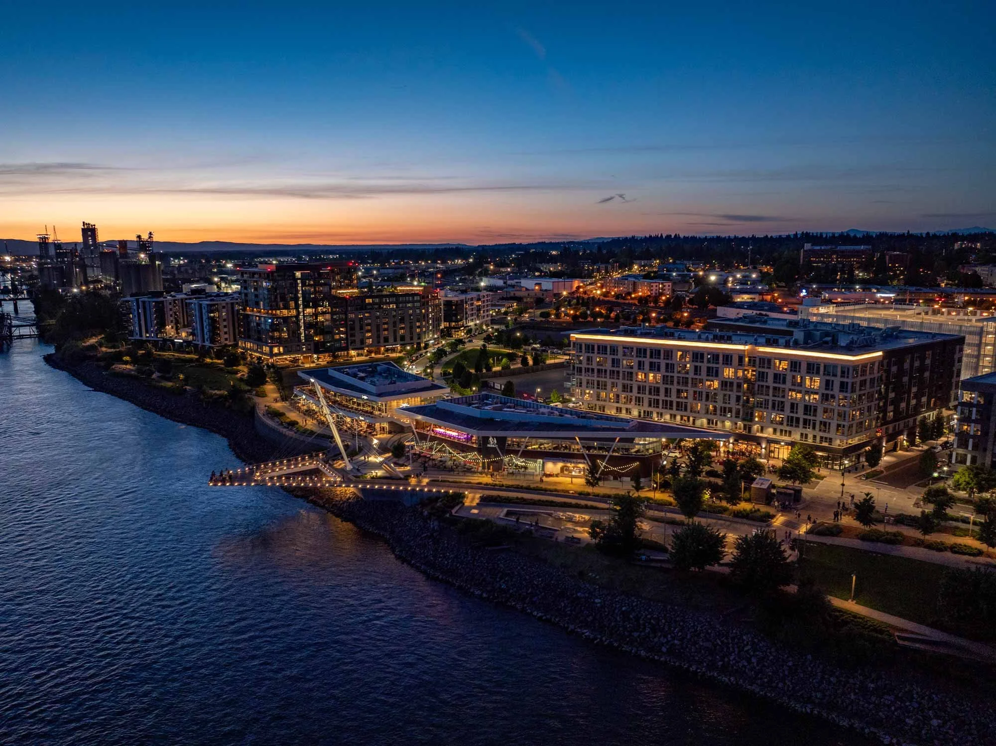
Welcome to the Waterfront Vancouver
The Waterfront Story
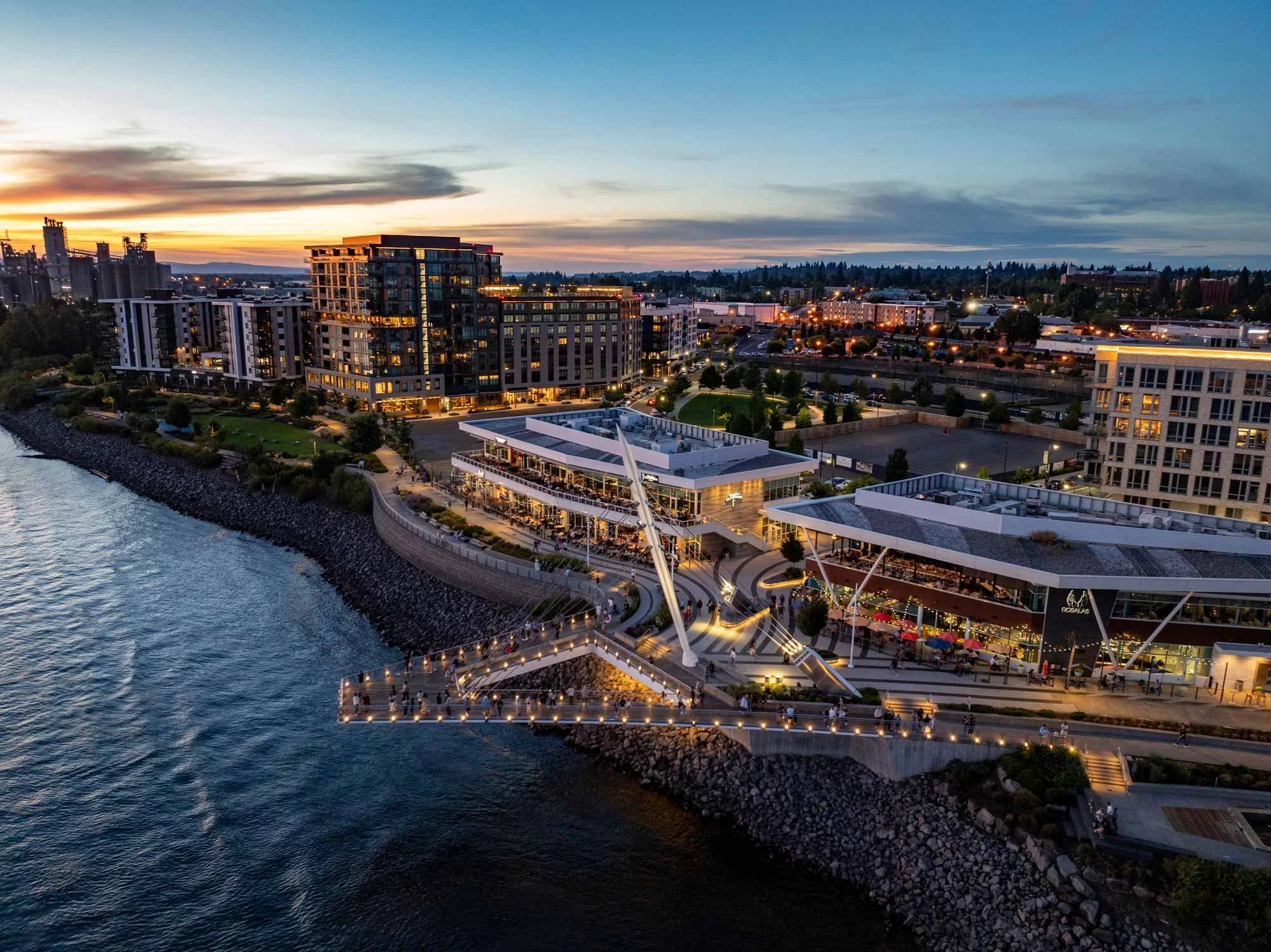
This dynamic development transformed an old industrial site into a thriving destination – reconnecting Vancouver, Washington’s downtown with its riverfront roots. It all came together thanks to an ambitious vision, strong local partnerships, and a commitment to excellence.


Losing connection to the Columbia River
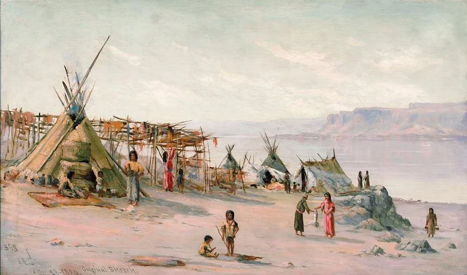
People have long inhabited this resource-rich shoreline and have been in close connection with the river. From the Native American tribes to the early European colonists, waterfront property wasn’t a luxury – it was essential to food harvest, security, transportation, and trade.
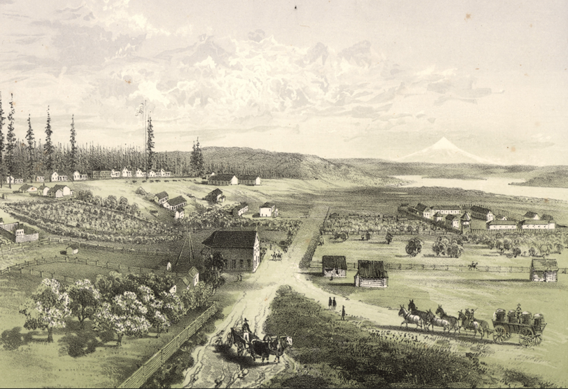
Fort Vancouver was established in 1824 as a Hudson’s Bay Company trading post and transferred to the United States in the 1840’s. The town of Vancouver grew from the fort and its supporting village, located close along the shore of the Columbia just east of today’s I-5 Bridge.
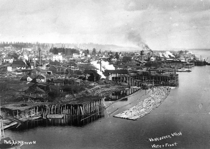
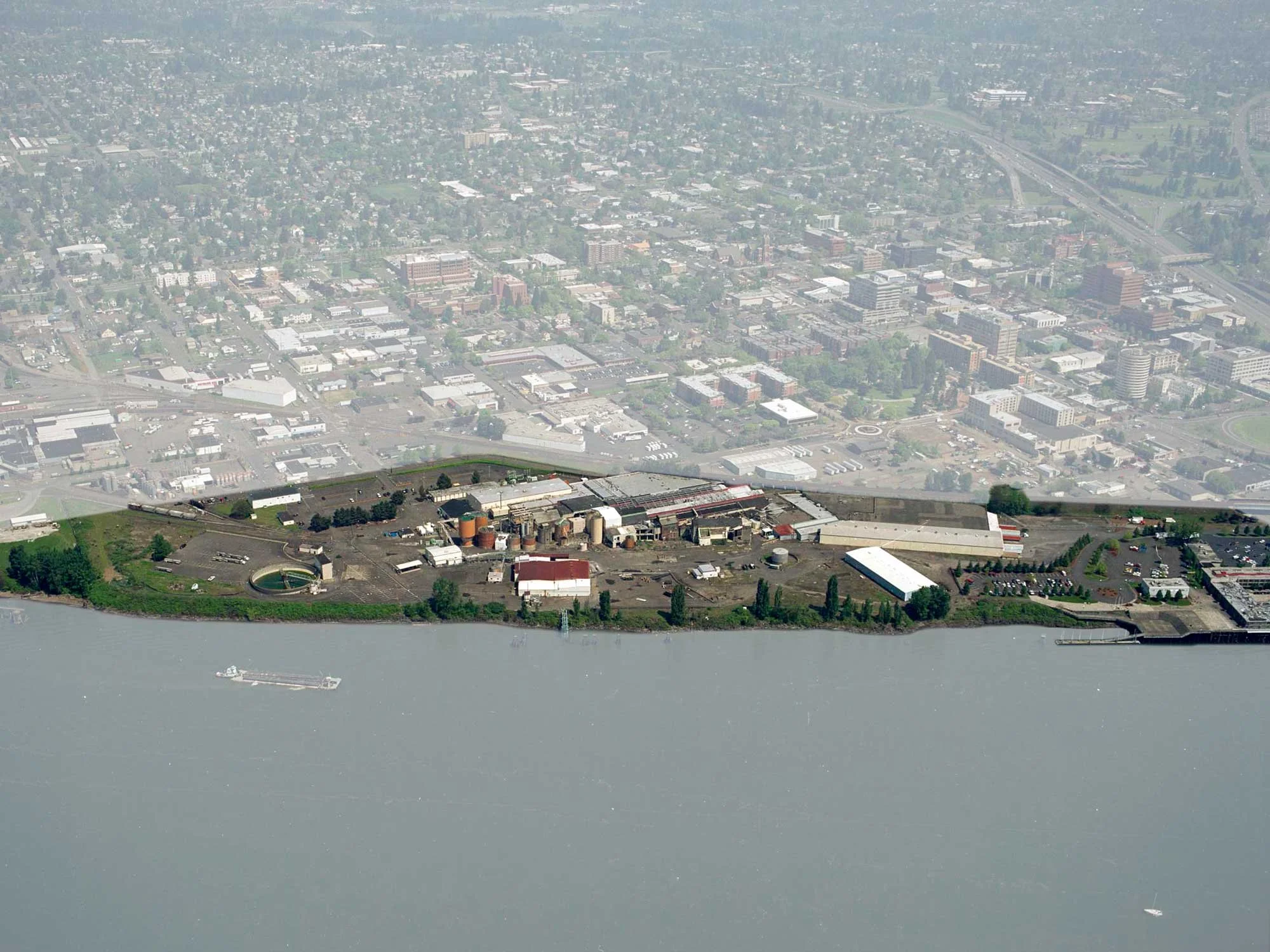
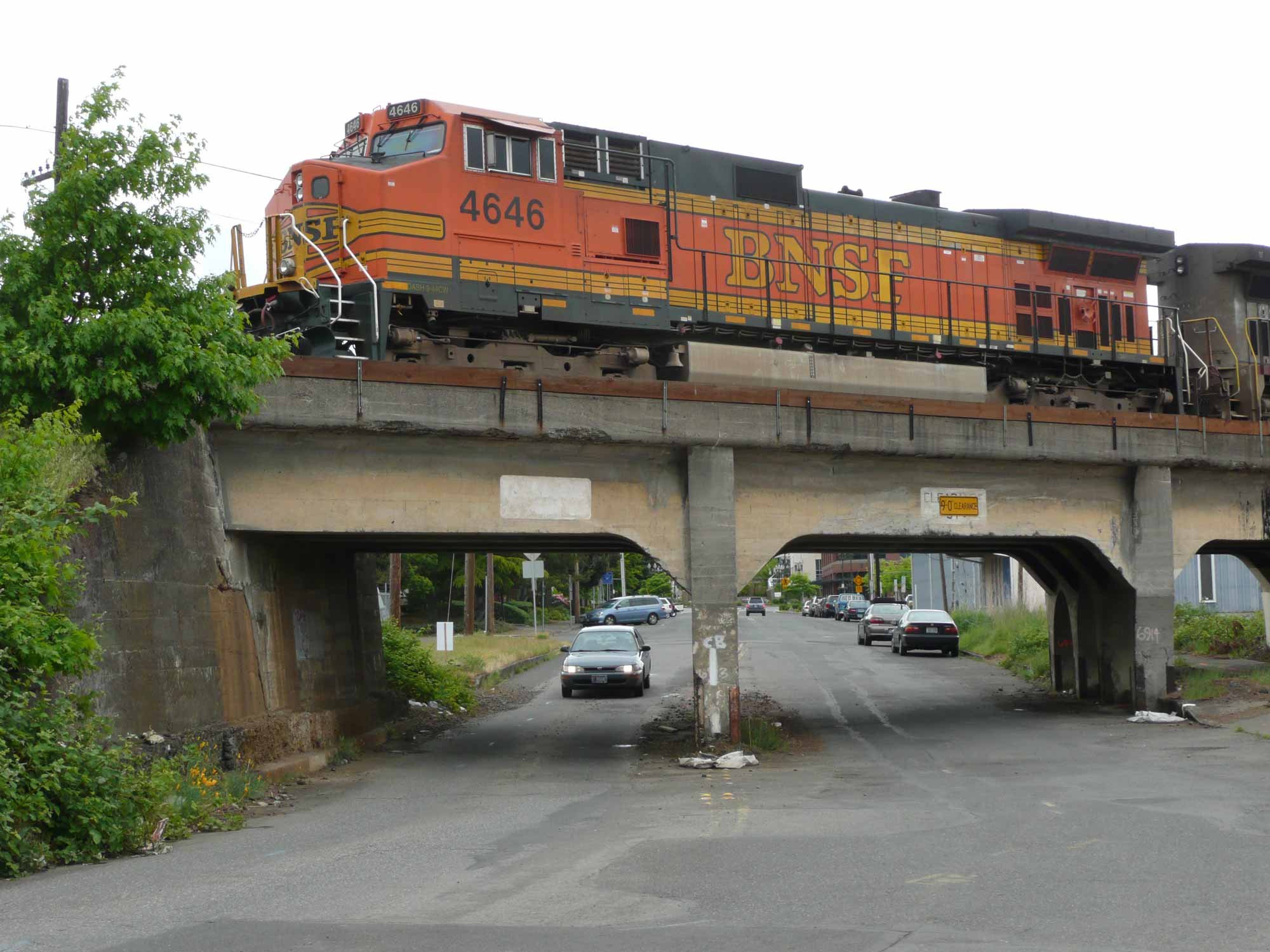
As Vancouver grew, lumber mills, railroads, shipbuilding, and other industries spread along the riverbank. In 1911, it was mostly consolidated to be sawmill and lumber finishing plant. In 1928, the site became a pulp and paper plant owned by Columbia River Paper. In 1962, Boise Cascade Corp. acquired the site.
The location of the paper plant along with the increasing ability for the citizenry to drive and live further away, led to an economic deterioration and general decline in downtown Vancouver.
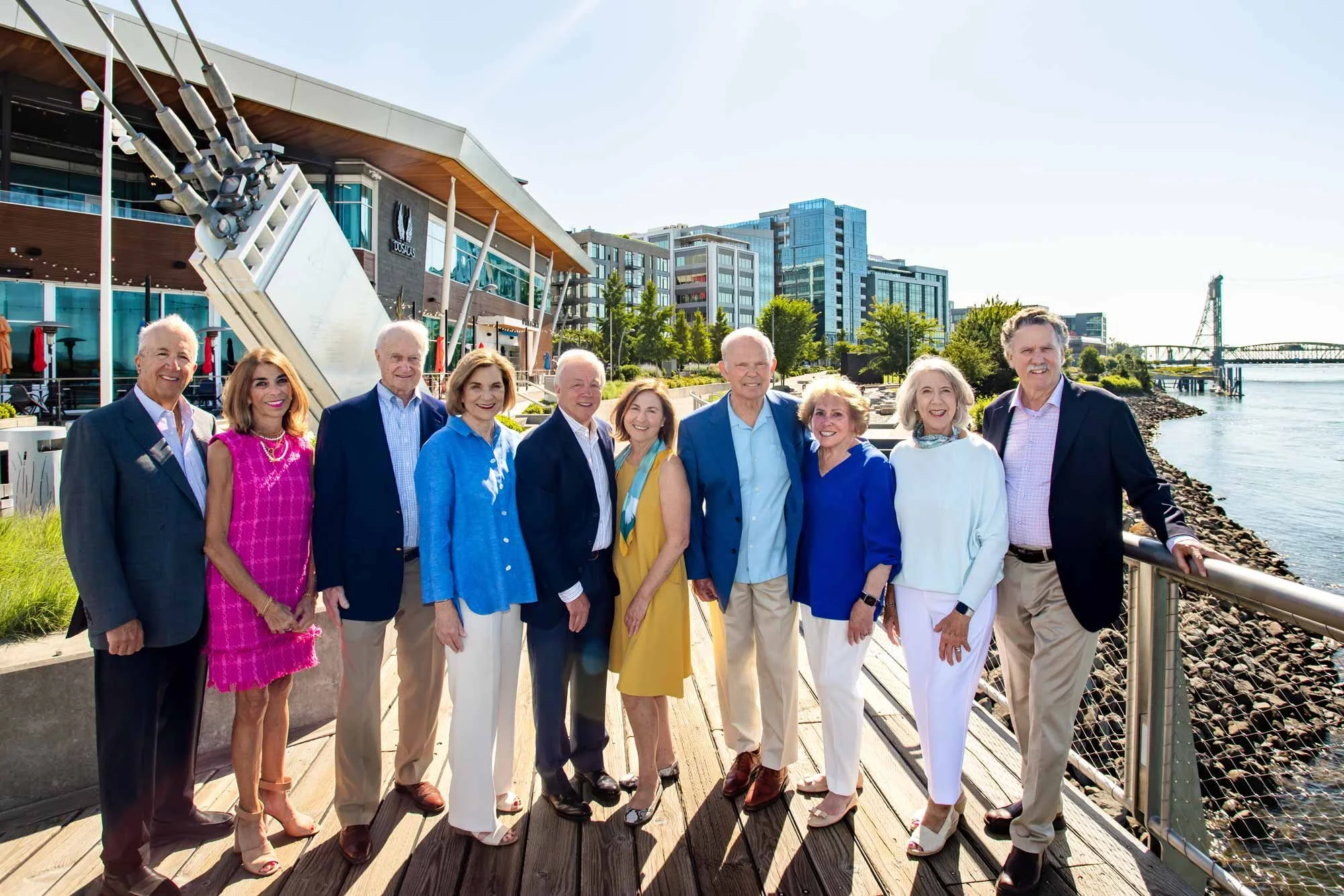
Columbia Waterfront LLC. From left to right: George and Paula Diamond; Steve and Jan Oliva, Barry Cain and Maria Hudspeth, Al and Sandee Kirkwood; Jo Marie and Steve Hansen
A bold vision
In 2005, Boise Cascade decided to close and put the 28-acre paper mill site up for sale.
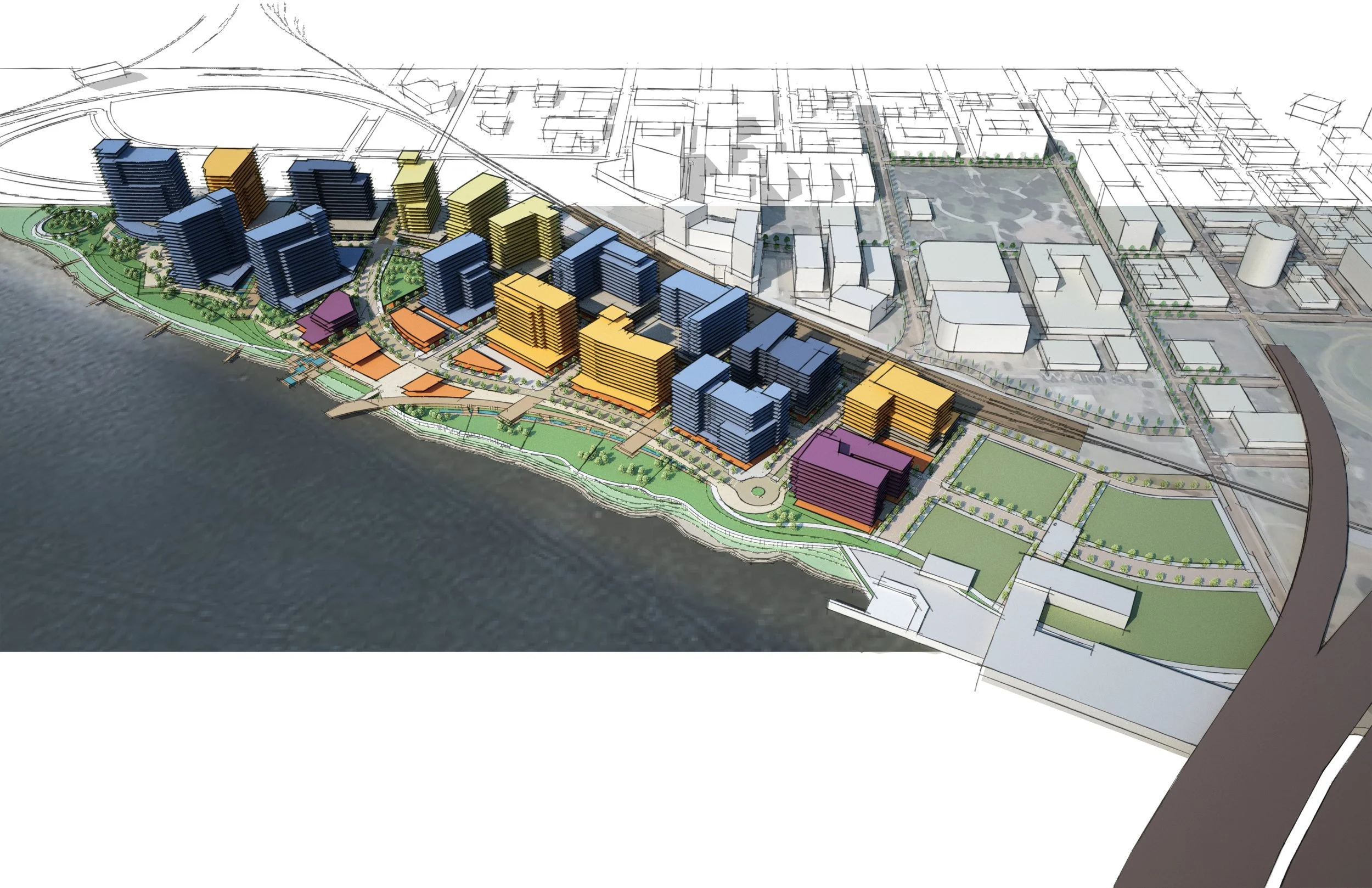
Local developer Barry Cain of Gramor Development, recognized the paper mill site as a once-in-a-lifetime opportunity. His vision was to transform the abandoned acreage into a world-class waterfront destination, to spark economic renewal and to set a new direction for Vancouver.
To purchase the property and set the project in motion, four local families joined Gramor to form Columbia Waterfront LLC. The group’s members were businesspeople and philanthropists with experience in real estate, construction and development – and, most importantly, a firm commitment to the future of Vancouver.
The Access Project
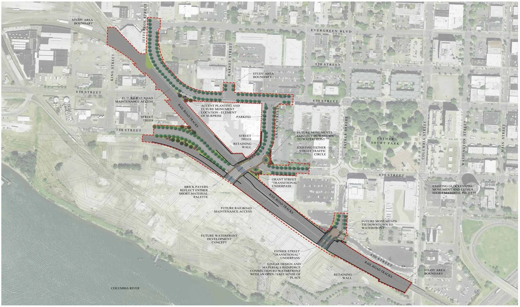
For The Waterfront Vancouver development to succeed as an urban waterfront, it needed a smooth seamless connection to downtown. However, a 100-year-old railroad embankment and trestle ran like a fortress wall between the city center and the old mill site.
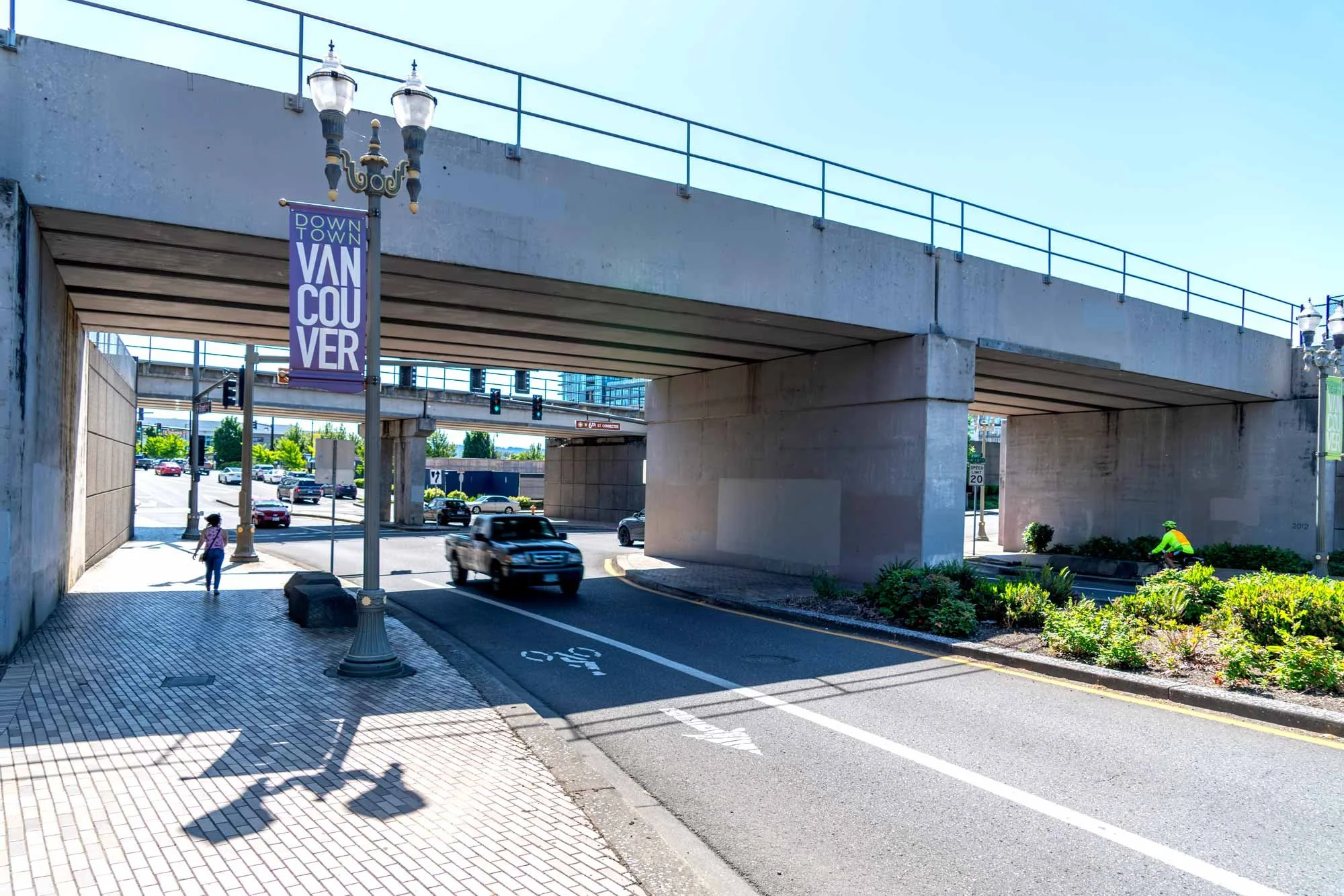
Together, the City and CWLLC contributed millions of dollars and raised millions more from federal and state grants and other funding. The City then coordinated the design and construction to realign the nearby roads and to rebuild the train trestle to have wide new openings at Esther and Grant Streets tying downtown Vancouver to the Waterfront. With the new road arteries and essential utilities established, The Waterfront Vancouver team began searching the country for the best park designers to create a world class unique park to welcome local residents and tourists to experience the awe-inspiring Columbia River.
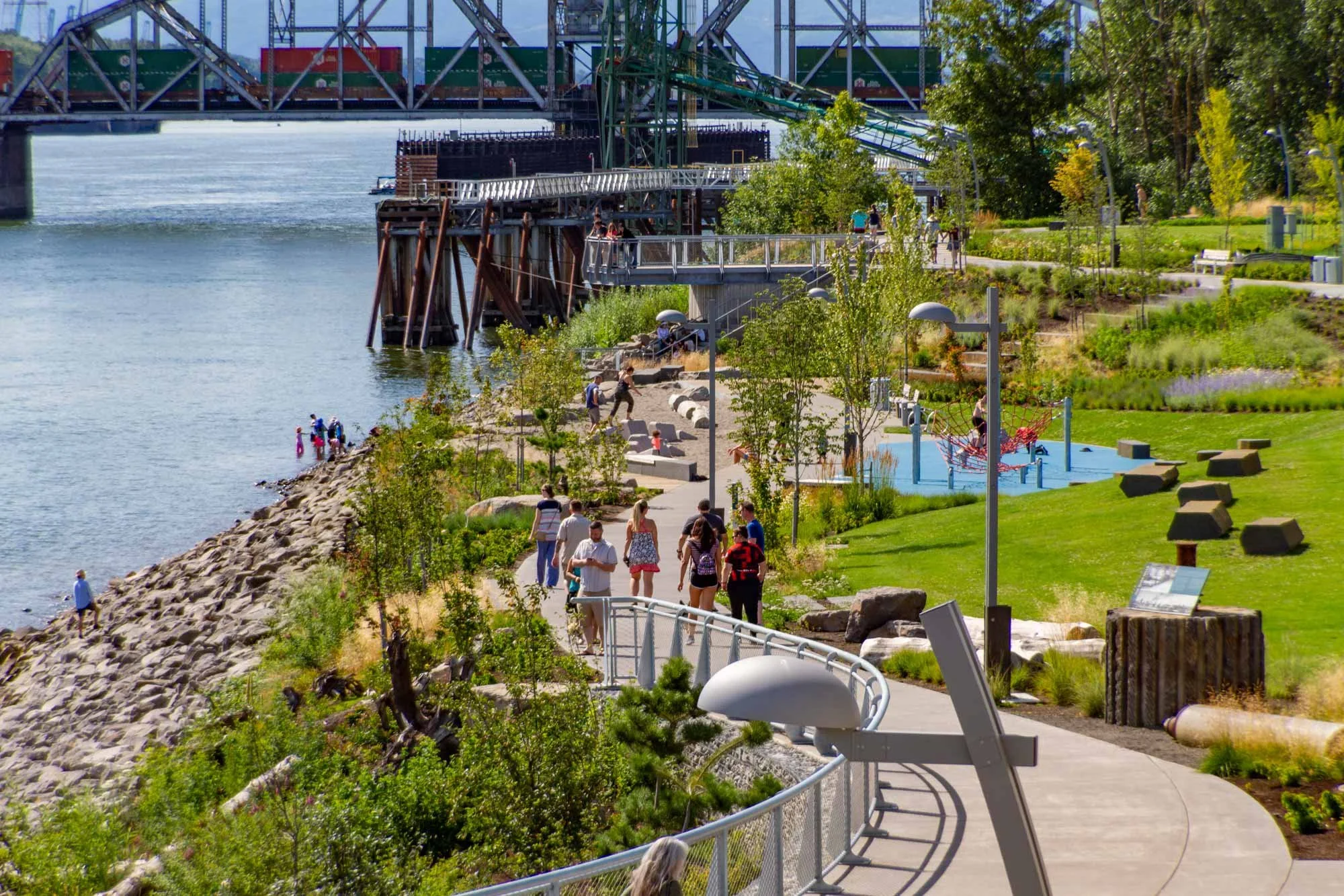
Creating a landmark park
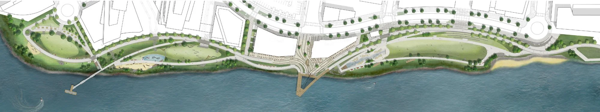
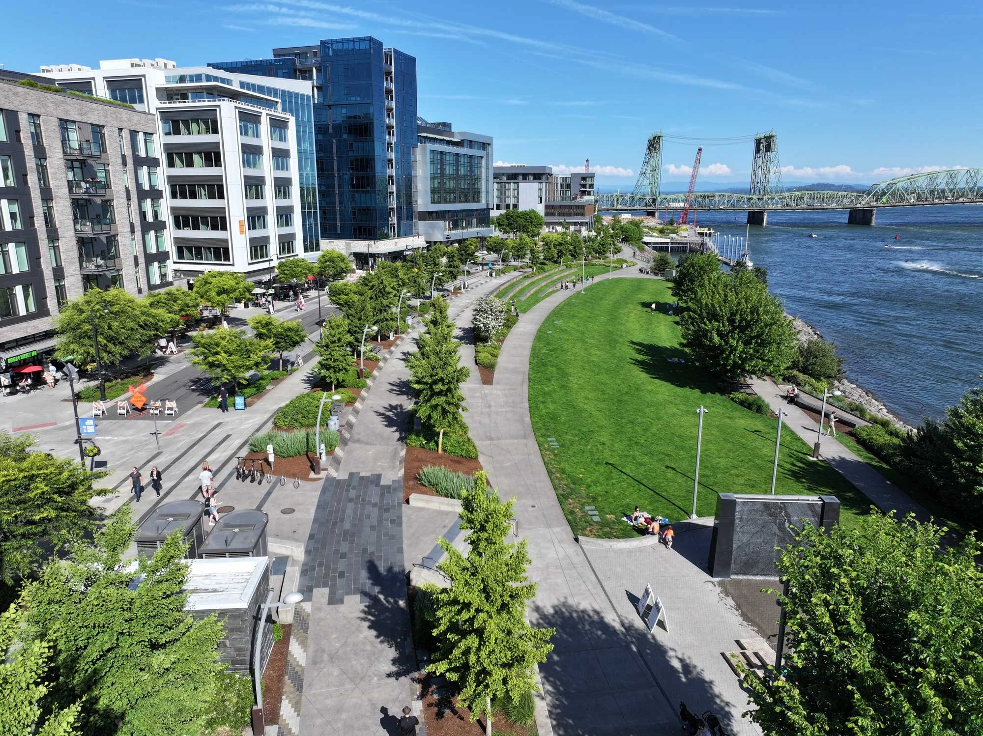
Internationally award-winning landscape architecture firm PWL Partnership was chosen to design the park. The winding walkways and flowing green spaces reflect PWL’s “place making” philosophy of integrating urban development with nature. The design echoes the flow of the river, bringing the rhythm of the Columbia into the city landscape, and incorporates a pier that integrates the park with the river itself.
The Public Art
The Grant Street Pier and The Headwaters Wall Water Features were designed by Larry Kirkland – a world-renowned public artist whose public art pieces help create meaningful places throughout the US.
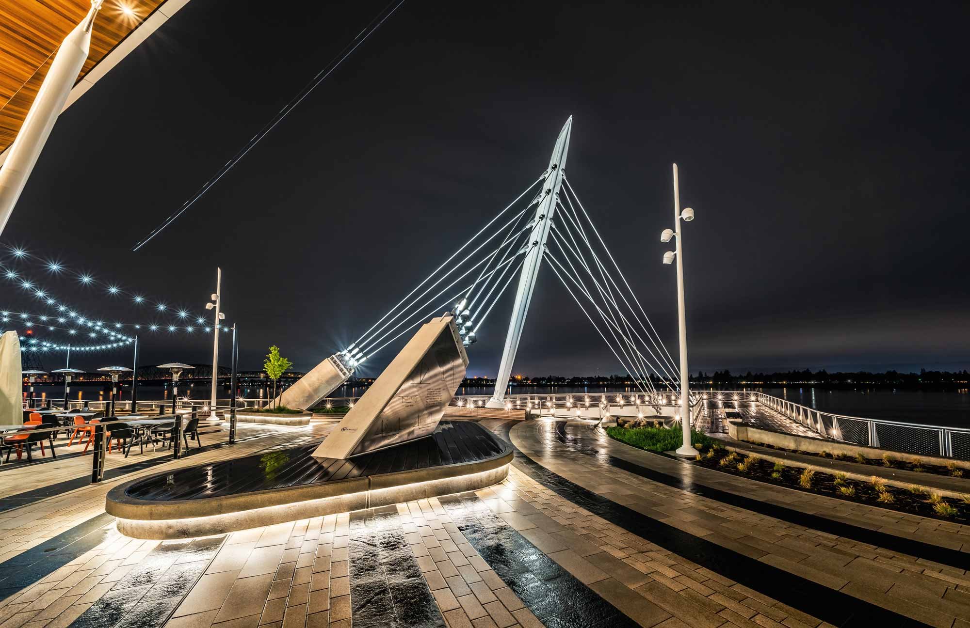
The dramatic design of Grant Street Pier is a nod to the sailing ship Columbia Rediviva, namesake of the Columbia River. The cantilevered, cable-stayed design evokes a ship’s rigging and bowsprit, flying over the water. The opening in the pier deck allows light through to the river, helping young salmon avoid predators as they migrate along the shore toward the ocean.
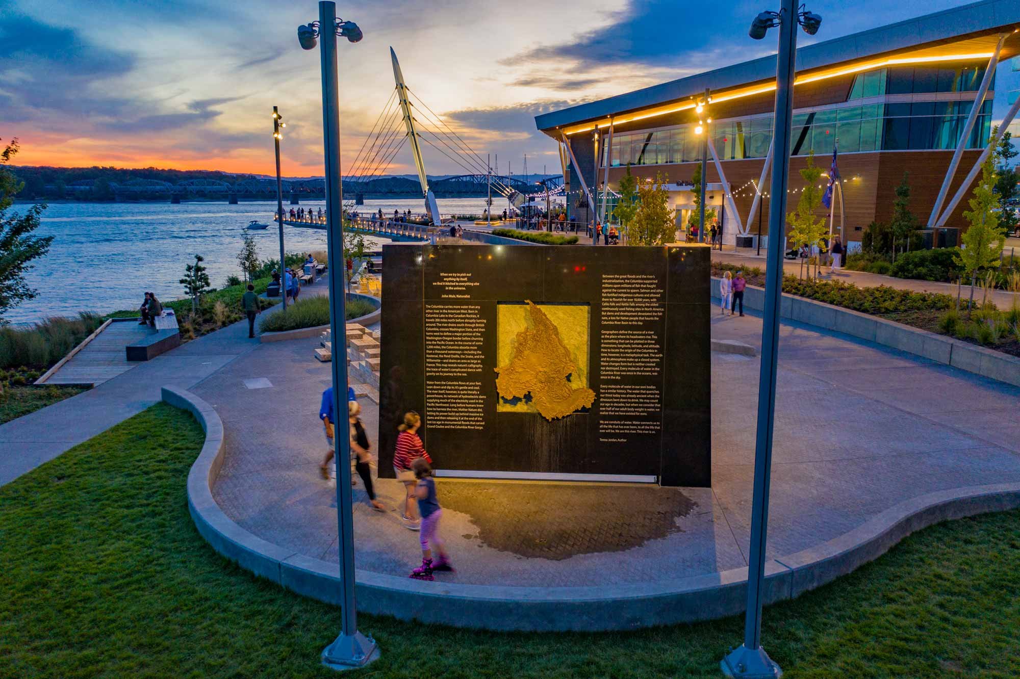
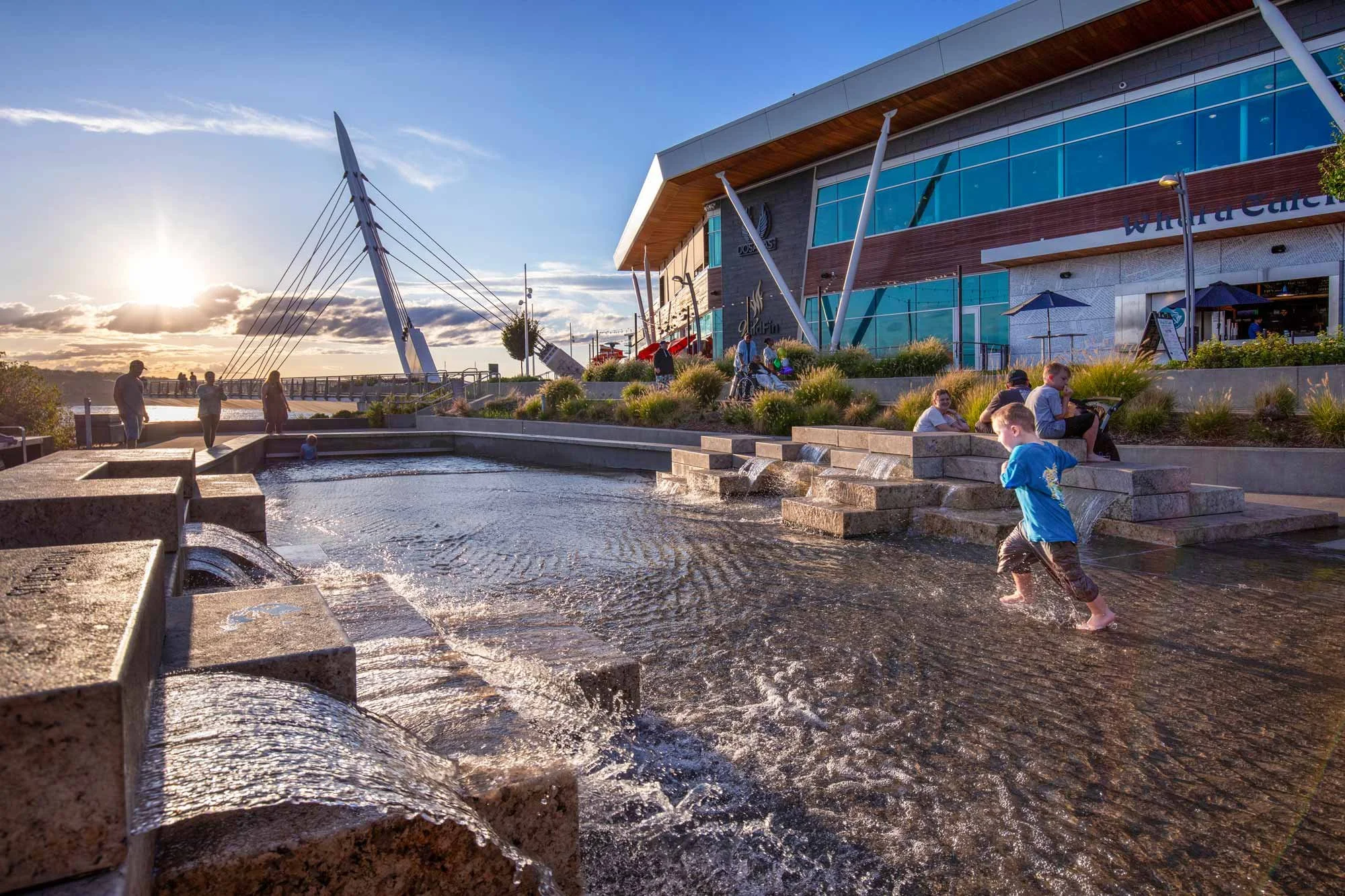
The Headwaters Wall Water Features invites play and learning. It features a bronze relief map of the Columbia Watershed flanked with text by renowned local author Teresa Jordan. The stepstone granite sculptures in the water play area represent the Columbia’s tributaries.
Lighting
The lighting for the park, Grant Street Pier and the Headwater’s Wall Water Features were designed by world-renowned lighting designer Charles Stone of Fisher Marantz Stone.
Populating the Pier
Grant Street Restaurants
Two flagship restaurant buildings adjacent to the Grant Street Pier and Headwaters Wall Water Features were designed by Portland Based LRS Architects.
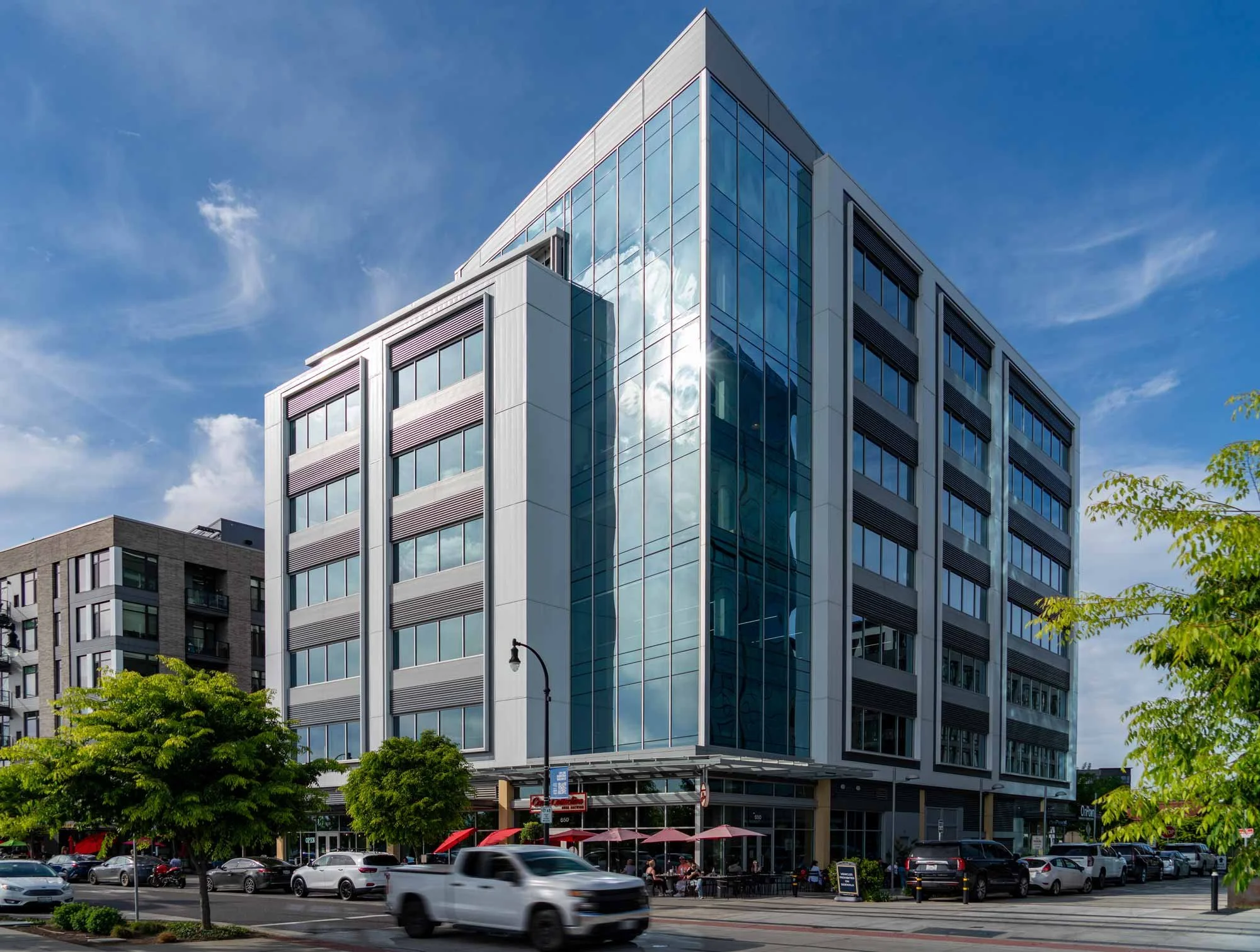
Murdock Foundation
The M.J. Murdock Charitable Trust was the first office tenant in the development, taking two floors in The Murdock Office Building and making it possible to start the first phase of The Waterfront Vancouver.
Return to the river
Some 20 years after seeing the potential in a shuttered paper mill, the vision of these local partners -to restore the link between the community of Vancouver and the Columbia River - has become reality. Today, The Waterfront Vancouver is an iconic destination that welcomes a new era to the City of Vancouver.

